Rajkot (Rājkot)
Rajkot is the third-largest city in the Indian state of Gujarat after Ahmedabad, Vadodara, and Surat, and is in the centre of the Saurashtra region of Gujarat. Rajkot is the 35th-largest metropolitan area in India, with a population of more than 2 million as of 2021. Rajkot is the 6th cleanest city of India, and it is the 7th fastest-growing city in the world as of March 2021. The city contains the administrative headquarters of the Rajkot District, 245 km from the state capital Gandhinagar, and is located on the banks of the Aji and Nyari rivers. Rajkot was the capital of the Saurashtra State from 15 April 1948 to 31 October 1956, before its merger with Bombay State on 1 November 1956. Rajkot was reincorporated into Gujarat State on 1 May 1960.
Rajkot has been under different rulers since it was founded. It has had a long history and had a significant influence in the Indian independence movement. Rajkot was home to many personalities like Mahatma Gandhi. Rajkot is in a transition period of growing cultural, industrial, and economical activities. Rajkot is the 26th largest city in India and the 22nd fastest-growing urban area in the world.
Rajkot was the capital of Saurashtra state from 15 April 1948 to 31 October 1956 before merging in bilingual Bombay State on 1 November 1956. Rajkot was merged into Gujarat State from bilingual Bombay state on 1 May 1960. Thakur Saheb Pradyumansinhji died in 1973. His son, Manoharsinhji Pradyumansinhji, has carved out a political career at the provincial level, succeeded him. He served as a Member of the Gujarat Legislative Assembly for several years and as the state Minister for Health and Finance. Monoharsinhji's son, Mandattasinh Jadeja has embarked on a business career.
On 26 January 2001 the 7.7 Gujarat earthquake shook Western India with a maximum Mercalli intensity of X (Extreme), leaving 13,805–20,023 dead and about 166,800 injured. This earthquake mainly affected the Kutch region of western Gujarat.
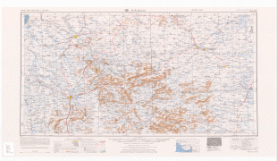
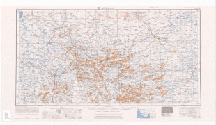
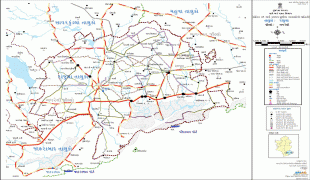
Map - Rajkot (Rājkot)
Map


Country - India
 |
 |
| Flag of India | |
Modern humans arrived on the Indian subcontinent from Africa no later than 55,000 years ago. Their long occupation, initially in varying forms of isolation as hunter-gatherers, has made the region highly diverse, second only to Africa in human genetic diversity. Settled life emerged on the subcontinent in the western margins of the Indus river basin 9,000 years ago, evolving gradually into the Indus Valley Civilisation of the third millennium BCE. By, an archaic form of Sanskrit, an Indo-European language, had diffused into India from the northwest. (a) (b) (c), "In Punjab, a dry region with grasslands watered by five rivers (hence ‘panch’ and ‘ab’) draining the western Himalayas, one prehistoric culture left no material remains, but some of its ritual texts were preserved orally over the millennia. The culture is called Aryan, and evidence in its texts indicates that it spread slowly south-east, following the course of the Yamuna and Ganga Rivers. Its elite called itself Arya (pure) and distinguished themselves sharply from others. Aryans led kin groups organized as nomadic horse-herding tribes. Their ritual texts are called Vedas, composed in Sanskrit. Vedic Sanskrit is recorded only in hymns that were part of Vedic rituals to Aryan gods. To be Aryan apparently meant to belong to the elite among pastoral tribes. Texts that record Aryan culture are not precisely datable, but they seem to begin around 1200 BCE with four collections of Vedic hymns (Rg, Sama, Yajur, and Artharva)."
Currency / Language
| ISO | Currency | Symbol | Significant figures |
|---|---|---|---|
| INR | Indian rupee | ₹ | 2 |
| ISO | Language |
|---|---|
| AS | Assamese language |
| BN | Bengali language |
| BH | Bihari languages |
| EN | English language |
| GU | Gujarati language |
| HI | Hindi |
| KN | Kannada language |
| ML | Malayalam language |
| MR | Marathi language |
| OR | Oriya language |
| PA | Panjabi language |
| TA | Tamil language |
| TE | Telugu language |
| UR | Urdu |